
This page sets out details of an outline application (with all matters reserved except access) submitted by Planning Prospects on behalf of Billingham & Kite Limited for a residential development of up to 58 dwellings, including affordable homes, on land north of Middlefield Lane, Hagley.
![]()
Billingham & Kite Homes are a long-established, family-run housebuilder and property developer with over 70 years of experience delivering high-quality residential developments across the West Midlands and Worcestershire.
Site description
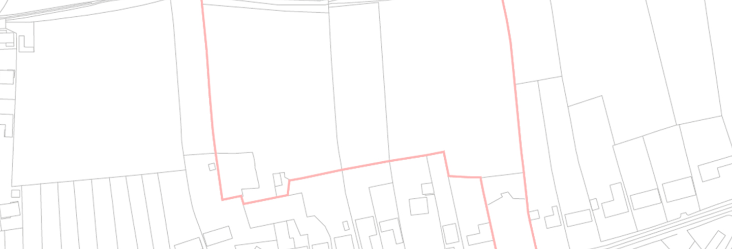
The site is located north of Middlefield Lane on the edge of the settlement of Hagley.
Positioned to the rear of existing dwellings fronting Middlefield Lane, the surrounding area is predominantly residential in character, with further dwellings to the south east and south west. Land to the east comprises the gardens of existing dwellings.
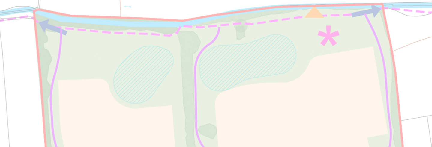
Church Brook forms the northern boundary of the site and is accompanied by established trees and landscaping, which enclosure the site. The North Worcestershire Path Public Right of Way runs alongside the brook along this northern boundary. To the west of the site lies a small copse of trees, beyond which is a paddock that is currently the subject of a planning application for residential development comprising 36 dwellings.
The application site includes three parcels of land comprising managed grassland with hedgerow boundaries.
The site also includes the plot of a former dwelling, which has since been demolished, following permission granted for its redevelopment to 2 no. dwellings (appeal reference: APP/P1805/W/18/3215106). Vehicular access to the site is proposed from Middlefield Lane.
Approach to application
An outline application (all matters reserved except access) is submitted for a residential development (including affordable homes) to deliver up to 58 dwellings. The indicative framework for the delivery of the site shows a comprehensively planned residential development, indicating the broad extent and distribution of the built form across the site within a strong landscape-led framework. This incorporates landscape buffers, internal green corridors, sustainable drainage features and an area proposed for play space.
The illustrative layout also demonstrates the retention of the existing Public Right of Way along the northern boundary, the maintenance and integration of existing trees and hedgerows where possible, and the provision of a safe and convenient access arrangement from Middlefield Lane. The layout is provided for illustrative and parameter purposes only, with layout, scale, appearance and landscaping to be determined at the reserved matters stage.
Planning
Within the adopted plan, the site is not allocated for development and is located in the Green Belt. However, the planning application proposals are on land which would be appropriately defined as Grey Belt.
In circumstances where Bromsgrove District Council is unable to demonstrate a deliverable five-year housing land supply, the relevant policies should be considered out of date. In this context and having regard to the national housing crisis and the need to deliver both market and affordable homes, development proposals of this nature should not be regarded as inappropriate in principle.
The proposals are supported by a comprehensive suite of technical assessments and plans, which demonstrate that the site is suitable for residential development and that all relevant policy considerations have been fully addressed.